QIKIQTARUK: THE VANISHING ISLAND
A photographic journey to a remote Arctic island
This digital portfolio showcases photographs taken during a 2018 expedition to Qikiqtaruk-Herschel Island in the Canadian Arctic, supported by the Environmental Awareness Bursary from the Royal Photographic Society and The Photographic Angle. The bursary allowed me to travel to this fascinating island with a scientific crew investigating the responses of the island’s ecosystems to climate change.
About the island
To get here, you probably chartered a bush plane or a helicopter from Inuvik, the nearest major town in the Northwest Territories of Canada. Or perhaps you navigated the sinuous meanderings of the Mackenzie River Delta and braved the waves of the Beaufort Sea to arrive by boat. If you are lucky, you may have spotted a pod of beluga whales - not to be confused with debris of floating sea ice - on your final approach.
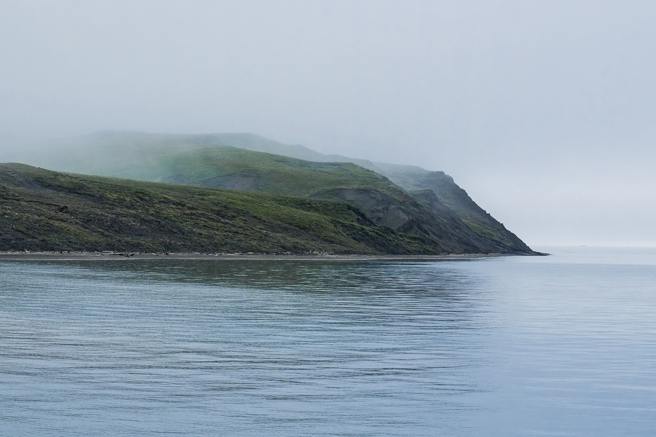
Qikiqtaruk - Herschel Island is a territorial park off the north coast of the Yukon Territory in the Canadian Arctic. Just around one hundred square kilometers in extent, the island is nonetheless home to a rich Arctic fauna and flora. And for a remote place without any permanent settlement, the island also has a fascinating history of human occupancy.
Sea ice is an important feature of the Arctic. Qikiqtaruk is typically completely enclosed in ice in the winter; during the summer, surviving blocks of ice come and go depending on the direction of the prevailing winds.
Sea ice in the Arctic follows a seasonal cycle of growth and thaw, and is at its minimum extent at the end of the summer. According to NASA, this minimum extent has been decreasing by 12.8% per decade, and we are now dangerously close to witnessing a completely ice-free Arctic Sea in the summer.
A group of glaucous gulls rests on an unusual formation of ice. Sea ice plays an important role in the life of many Arctic animals, from seals to polar bears, and its dramatic reduction in the last few decades forces animals to travel further to give birth to their young or to hunt.
Qikiqtaruk is a treeless island above the Arctic circle. However, its shores are rich in driftwood that has been carried over hundreds of kilometers through the Mackenzie river delta into the Beaufort Sea.
Fog can roll in very quickly on Qikiqtaruk, leaving you blind to everything further than a few meters away. Beware of bears!
In the short Arctic summer, the tundra springs to life with a surprising variety of grasses, flowers and shrubs. There is evidence that the tundra is “greening” due to increased plant growth, something that can even be detected by satellites.
In parts of the island, wild flowers bloom and carpet the tundra. This pretty species is Castilleja elegans.
This western Arctic shooting star (Dodecatheon frigidum) is a relatively rare find on the island. It grows in wet, boggy places, and is here covered in morning dew.
The feathery seed filaments of Dryas integrifolia (mountain avens) originally develop tightly twisted, and open up as the seeds are ready to be dispersed and colonise the tundra.
Natural history of Qikiqtaruk
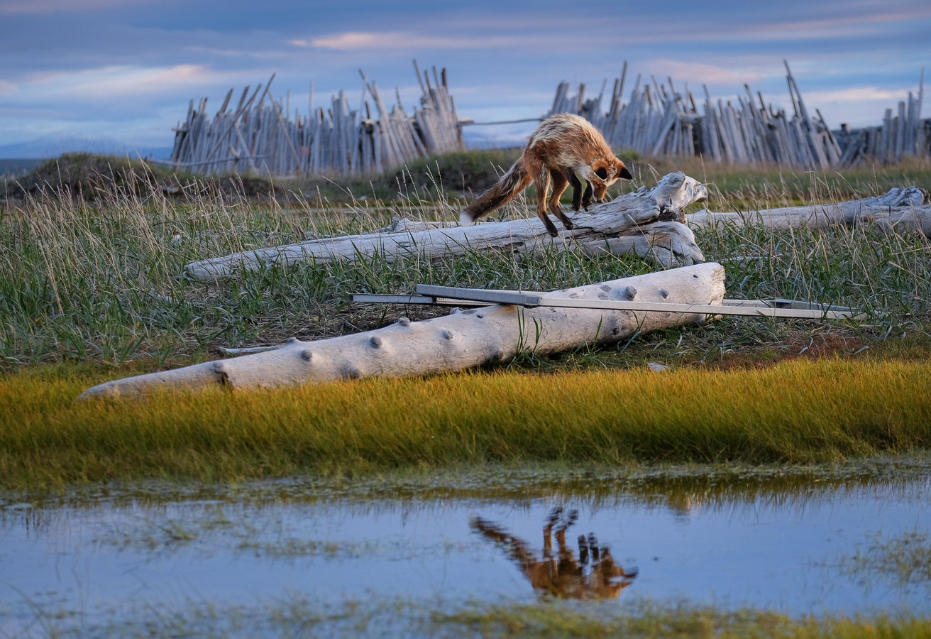
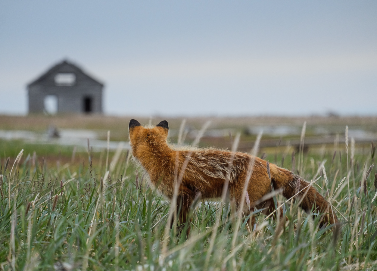
Qikiqtaruk is made from frozen sediments that were once pushed and piled up by an ice sheet. After the Ice Age, the sea level rose, breaking the connection to the mainland and creating the island. A 3-km wide strait separates Qikiqtaruk from the Yukon north coast, which means that good swimmers like bears and caribou can go back and forth as they please, although other animals such as muskoxen can only get to the island while there is sea ice. This means that population numbers fluctuate from year to year depending on how many animals get stranded there in the summer!
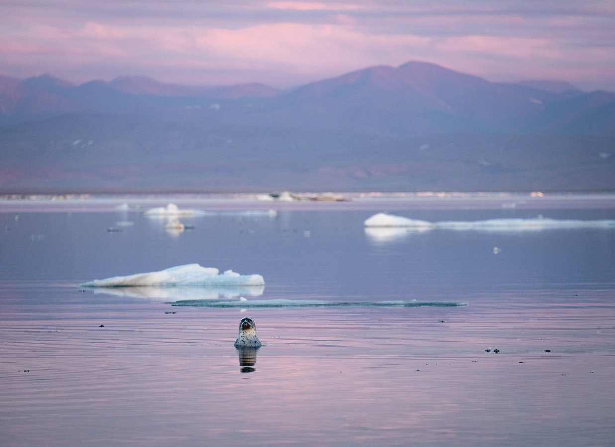
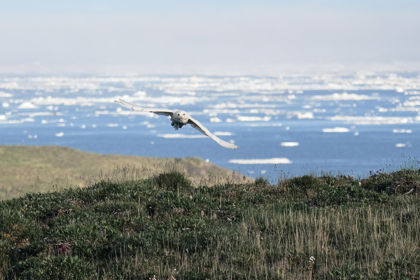
The shallow, nutrient-rich waters around the island attract marine wildlife such as beluga and bowhead whales, several species of seals, and sea birds like black guillemots and eider ducks.
A ringed seal coming to the surface to breathe - and to take a look at the strange photographer on the shore. The rich waters around Qikiqtaruk make it an ideal habitat for marine mammals such as seals and whales.
Foxes have excellent senses and can detect lemmings and voles scurrying in the grass. They can predict the trajectory of their prey and jump to attack from above, a behaviour called “mousing”.
An eider duck amidst drifting sea ice on the calm Beaufort Sea. Eiders are northern sea ducks living in colonies. Their very warm down keep their eggs toasty in cold Arctic conditions.
A snowy owl takes flight after resting on the tundra. There are no trees on the island, so owls like to perch on elevated mounds of earth or on a hillside to survey their surroundings. They nest on the ground and feed primarily on lemmings, although they can also hunt larger mammals and birds.
Muskoxen have a strong social structure and usually live in herds of one or two dozen animals. Unlike their name suggests, they are more closely related to sheep than to cattle.
Only around three kilometers separate the mainland from the nearest part of the island, and this distance is made even smaller by long spits of sand advancing into the sea. This makes the crossing easy for good swimmers like bears or caribou.
A ringed seal swims lazily in the shallow waters of a sheltered cove close to camp. The smallest of Arctic seals, ringed seals are widespread in the northern polar region and live on and around the ice. They feed on fish and marine invertebrates, and are a key prey to polar bears.
The ptarmigan is found at high latitudes and in some mountain regions of the Northern Hemisphere, and is well adapted to life in the seasonally contrasting tundra. Its plumage, a mottled brown in summer, turns to pure white in winter, making the bird a master of camouflage. It feeds mainly on the buds of shrubs such as willows and birches.
Red foxes have a large geographic range and can be found all the way up to the Arctic Circle. With climate change creating more suitable conditions for red foxes at higher latitudes, the species may increasingly become a threat to the smaller and less competitive Arctic fox.
A semipalmated plover chick makes hesitant steps in the sun-drenched, marshy grass near camp. Semiplamated plovers are ground-nesting shorebirds. Parents will distract potential predators away from the nest by faking a broken wing while running in the opposite direction.
Survivors of the Pleistocene era, muskoxen now face rapid environmental change, as evidenced by the pockmarked hill in the background, where thawing permafrost has led to massive ground collapses.
Snow buntings are passerine birds well adapted to life in the Arctic, where they breed and spend the summer. However, they migrate to more temperate latitudes to overwinter. Males are easily recognisable due to their bright black and white plumage.
Human heritage
A view of camp from across Pauline Cove. The cove offers protection from the rougher waves of the Beaufort Sea, and as such was an ideal base for the 1890’s whalers to moor their ships.
Shelters made of driftwood protect campers against strong winds during storms. There is nothing better than going to sleep listening to the creaking of the ice, the calls of seabirds and the occasional breathing of a whale.
A ringed seal drifts by the abandoned mission house on the edge of camp. Built by Anglican missionaries in the early 1900’s, the derelict building is now home to a colony of black guillemots and fitted with nestboxes where the birds can breed.
Thunderstorms are relatively rare in the Arctic, but may become more frequent with climate change causing warmer air temperatures in the summer. It was a rather exciting night sleeping in the wooden tent shelters with the lightning flashing overhead!
A snowy owl sits on a century-old ice house. The whalers living on the island at the end of the 19th century blasted holes in the frozen ground to store food. Now, with rapidly degrading permafrost, only one house remains standing, and has recently become too unsafe to access.
Foxes are curious creatures who do not hesitate to venture into urban areas - or into camp! This particular fox became a daily visitor and could often be seen hunting for voles near the abandoned Anglican mission house.
The territorial park of Qikiqtaruk - Herschel Island was established in 1987 by the Yukon Government to preserve the island’s natural environment and significant cultural heritage.
The island lies within the traditional grounds of the Inuvialuit, whose presence dates back at least a thousand years. “Qikiqtaruk” simply means “island” in Inuvialuktun. Today, the park is still a hunting ground for the Inuvialuit, and a place to teach youth traditional customs.
Qikiqtaruk was first described to the European world in 1826 by the ill-fated Admiral Franklin during one of his Arctic exploration trips. Franklin named the island Herschel after scientists and astronomers William Herschel and his sister Caroline.
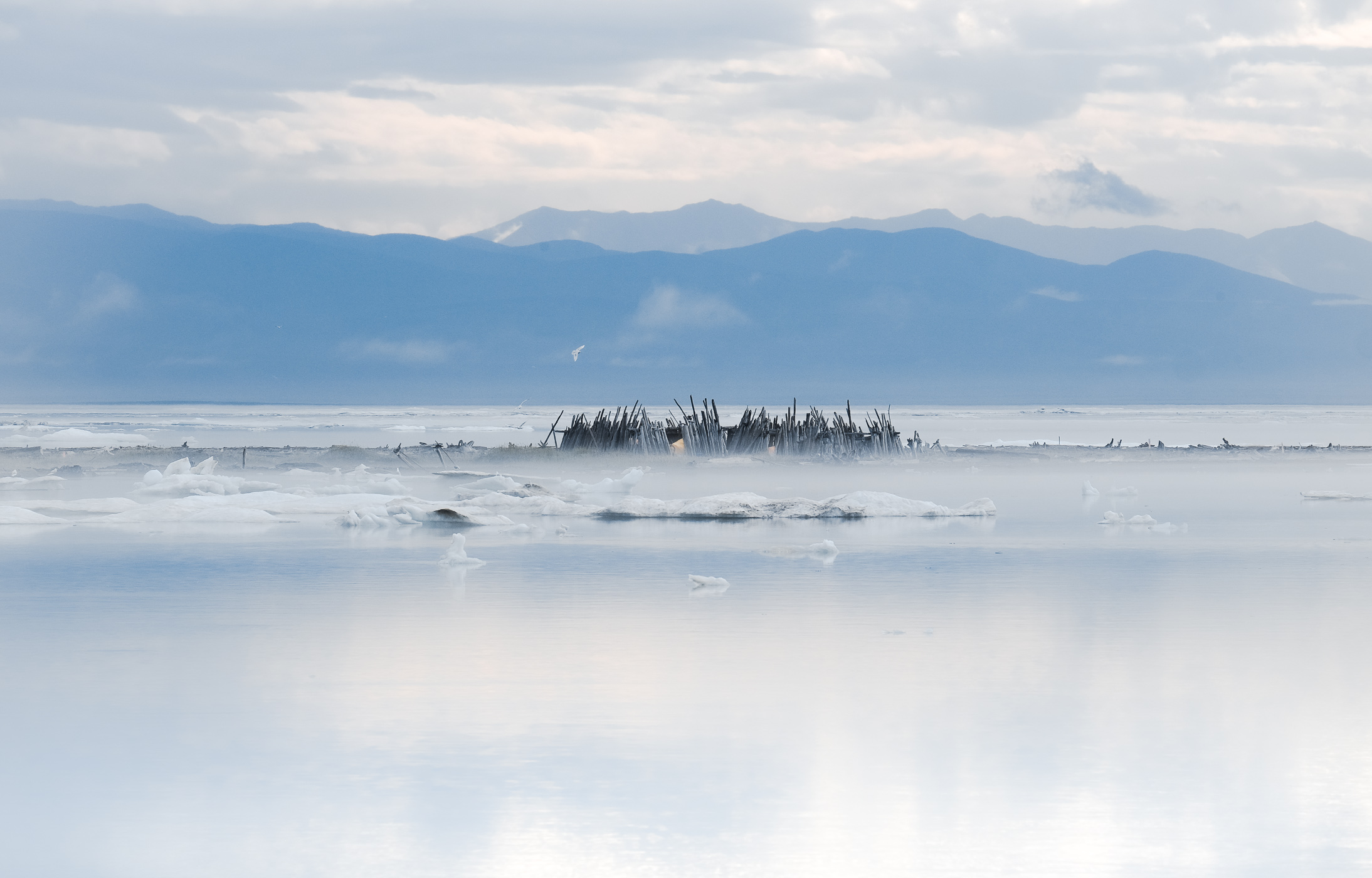
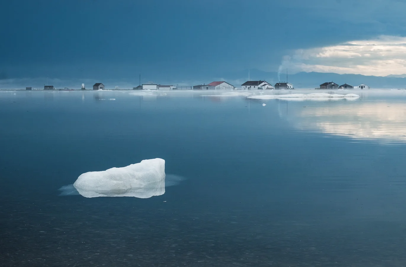
At the end of the 19th century, American and European whalers came to hunt bowhead whales, and the island’s population rose to nearly 2,000 for a brief period. However, the unsustainable harvest of whales meant that the trade went down quickly, and a decade later most whalers had left. Around that time, the Canadian Mounted Police established a station to increase the national presence in the Arctic. The fur trade continued for a while, but this dwindled down, too, and the Hudson Bay Company left in 1937. The police left in 1964, putting an end to year-round occupation of the island. Nowadays, the island receives small groups of Inuvialuit, park conservation officers, tourists, and scientists, mostly in the summer.
The Pauline Cove settlement on Qikiqtaruk often gets flooded when sea level rises during a storm.
A changing island
The environment of Qikiqtaruk is changing rapidly: the Arctic is warming around twice as fast as the rest of the planet, and consequences are already felt there. The rich wildlife, varied habitat types, and special geomorphology of the island make it a prime location to study environmental change. Qikiqtaruk is a living laboratory where researchers, in collaboration with the parks rangers and the Yukon government, monitor long-term changes in the landscape, from shifts in the abundance of certain plants to rates of coastal erosion.
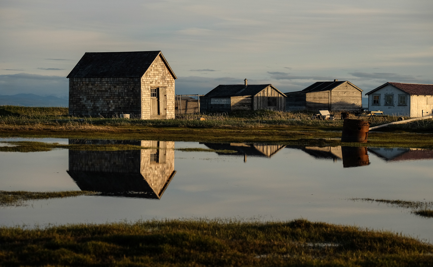
Climate change also threatens the human heritage of the site. Some of the historical buildings have already been moved to prevent them being lost at sea. The Inuvialuit and whalers grave sites on the coast are also at risk.
When the ice in frozen tundra soils melts and drains away under climate change, the ground collapses, and the exposed permafrost thaws more quickly. Eventually, a large thaw slump is formed: this one is about two kilometers in extent and has a 30-meter tall headwall.
The shallow, thawed layer of soil in which plants grow is slowly sliding off the edge of the thaw slump. Sediments will then be eroded away into the sea. An ice wedge, formed over potentially hundreds of years of water infiltration through the soil, is also visible here along the headwall of the slump.
Sandhill cranes fly over the edge of the slump. The slumps provide a different type of habitat for the wildlife of the island, and are often frequented by caribou and bears.
In the Arctic, seasonal freeze-thaw cycles frequently cause disturbances in the ground. This churning frees up new sites for plants, and scientists have observed a decrease in bare ground on the island due to rapid establishment by plants.
Thawing of the permafrost combined with wave action on the coast has destabilised the ground, and as a result a whole chunk of the island has fallen into the sea.